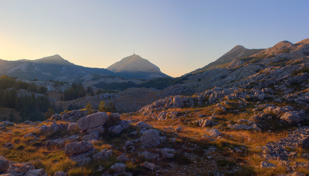
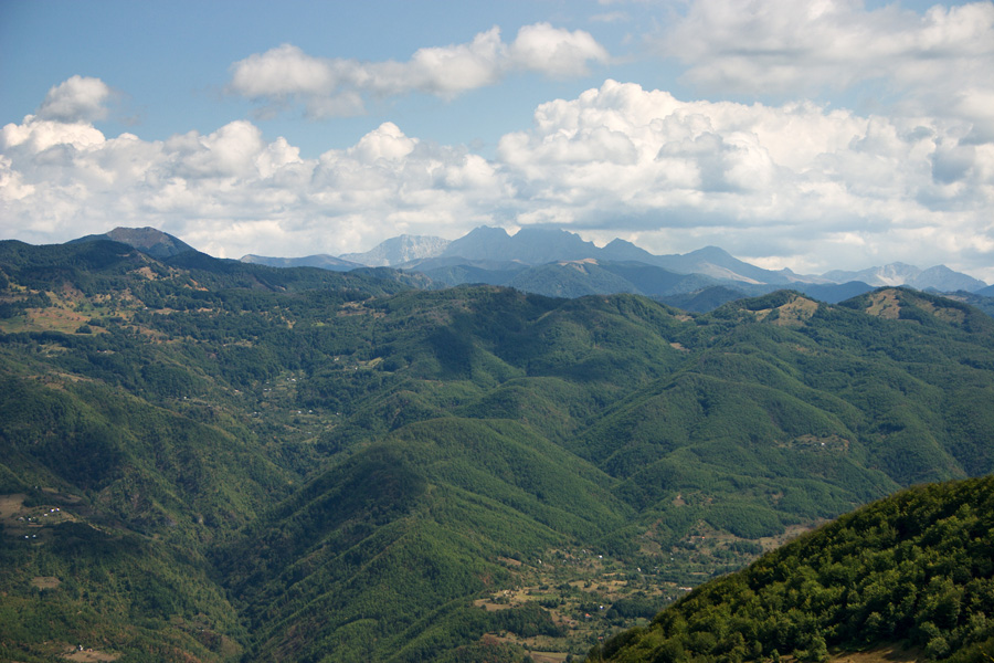
Crna Gora (Montenegro) August 2007.
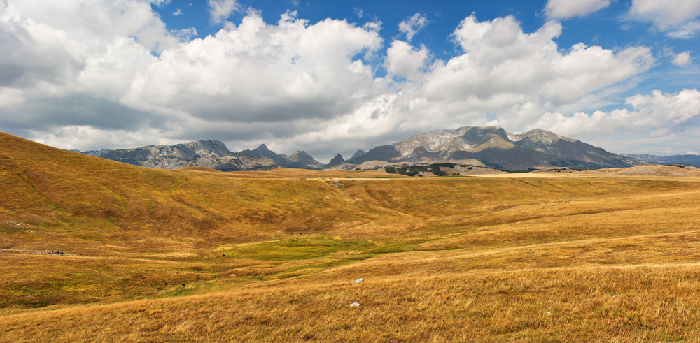
Tali and Sinjajevina Mountain
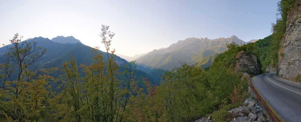
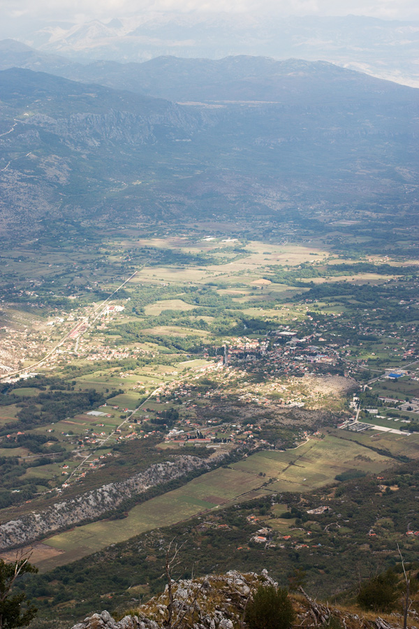
Late afternoon photograph from the road descending from Crkvine saddle down to the Mijoska village and river Morača canyon. (HDR)

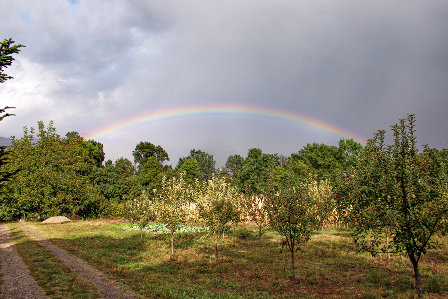
Ex-Cornfield Panorama (VR)
There was once a cornfield here, on my father's ranch in Počijevka village near Danilovgrad. This region is called Bijelopavlići plane, named after one of the Montenegran tribes whose descendants still live here. Filipović family comes from Brajović family which is a large brotherhood in Bijelopavlići.
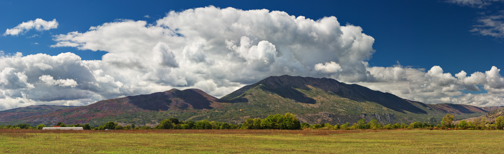
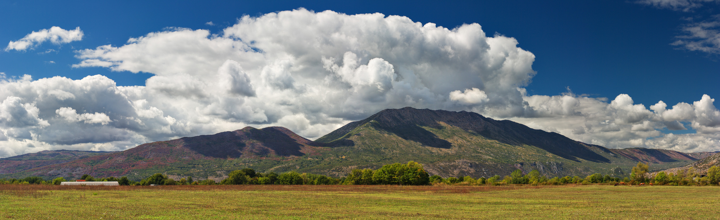
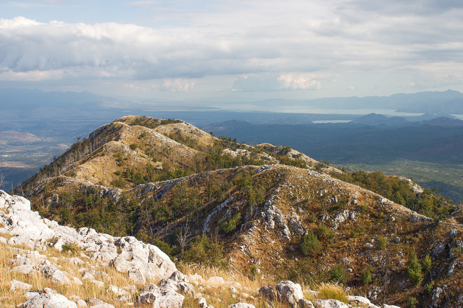
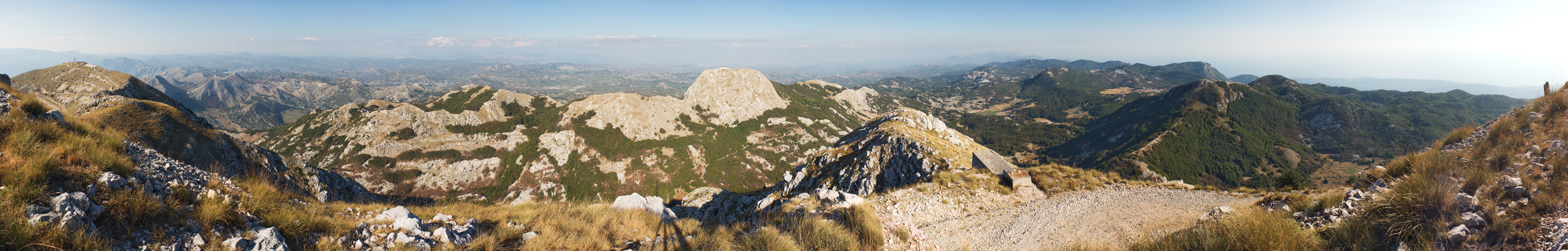
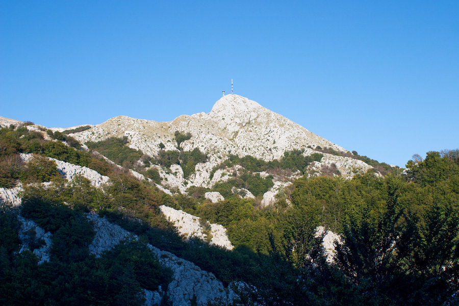
Garač Mountain
A prominent mountain above Bijelopavlići plane and river Zeta valley. With an elevation of 1436 meters, it rises 1370 meters above the flat valley and Danilovgrad city below.
Larger size image
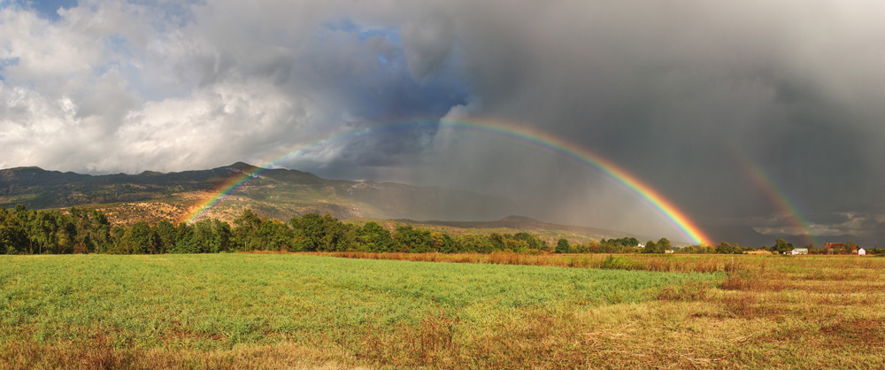
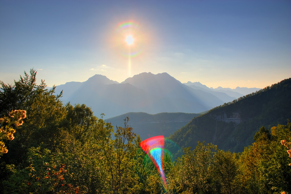
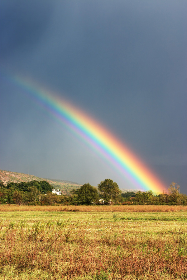
Rainbow from Počijevka Village
North facing view of the Bijelopavlići plane, towards the Sige and Luke villages.

Garač Mountain Panorama (VR)
Milunova Bobija, the summit of Garač mountain at 1436 meters offers a nice view. Lake Skadar and Podgorica city lie in the eastern direction along the mounain's ridge. Among a dozen of nearby mountains, a tiny portion of Adriatic Sea can also be seen (SW direction, to the right of Lovćen mountain).

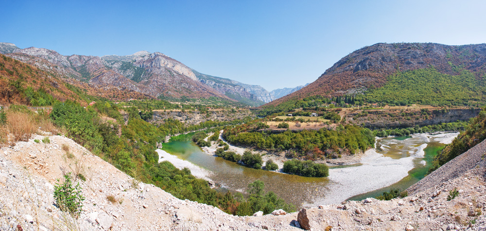
River Morača
The longest river in Montenegro, this photograph was taken a couple of kilometers upstream from Podgorica city. The river is flowing out of its canyon ahead that now serves as a major road and rail link, although it was previously inaccessible.
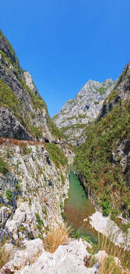
Morača River Canyon
This is the deepest part of this very attractive canyon, with the average depth of around 1000 meters. Straight ahead in the photograph is Rovačka Glava peak (1328 meters) towering almost 1200m above river bed level which is at 135m.

Canyon Platije Panorama (VR)
The narrowest and most attractive part of the canyon is called "Platije", and is little more upstream from the deepest point. A full spherical panorama is the only way to present this magnificent place.

Canyon Platije Panorama (VR)
Morača river view from the old closed section of the road going to Podgorica. The new section of the road goes through a tunnel, unfortunately making this part of the canyon invisble to most travelers. However, you can access this place on foot if you park your car on the right side of the road before the tunnel entrance when heading north from Podgorica (the place where the previous panorama was shot).

Canyon Platije Panorama (VR)
Downstream view of the Platije canyon. To the right you can see tunnels of the old section of the road that is now closed after a large slab of rock broke loose from the first tunnel's entrance and fell to the pavement. For safety reasons, a new tunnel has been built that runs more deeper into the hill.

River Morača Canyon
This would be the entrance to the canyon if you were following the river flow. Platije are approximately 2 km downstream.
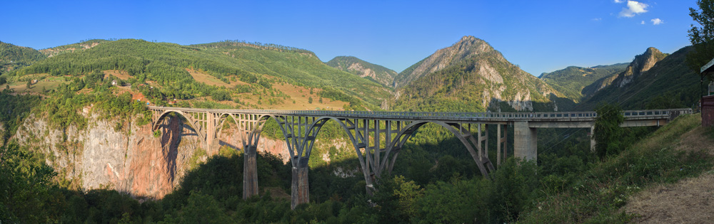
The Bridge on River Tara
Afternoon photograph of the famous 365 meters long bridge whose main arc is 150 meters above the water. Construction started in 1937, and the bridge was finished just before the WWII. At that time it was the second highest bridge in Europe.
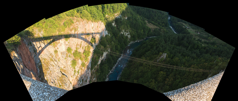
The Bridge on River Tara
View of the river Tara from main arc of the bridge.

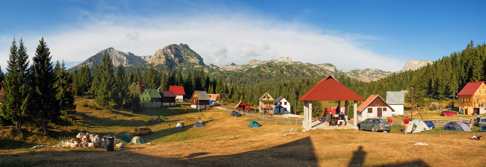
Saddle on Durmitor Mountain (VR)
Evening panorama of the landscape below Sedlena Greda peak on Durmitor mountain. Sedlena Greda is the twin peak ridge that resembles a horse saddle.
Durmitor Mountain
Durmitor mountain from the campsite at Ivan Do. From left to right, Savin Kuk, Međed and Bobotov Kuk massif can be seen.

Durmitor Mountain
Durmitor mountain view from Virak village. The base plateau stretching southeast from the mountain is called "Jezerska Visoravan" (Lake Plateau), a wide grassland area with an elevation of around 1400 meters. The mountain itself has numerous peaks of around 2400 meters, the highest one is called Bobotov Kuk and is 2522 meters high. Larger size image

Durmitor Mountain (VR)
Durmitor mountain view from Vražija Glava hill. Approximately from here, a highland plateau called Jezerska Visoravan (Lake Plateau) stretches from Durmitor towards Sinjajevina mountain in the southeast.
Durmitor Mountain
Durmitor mountain from the road to Šavnik city.
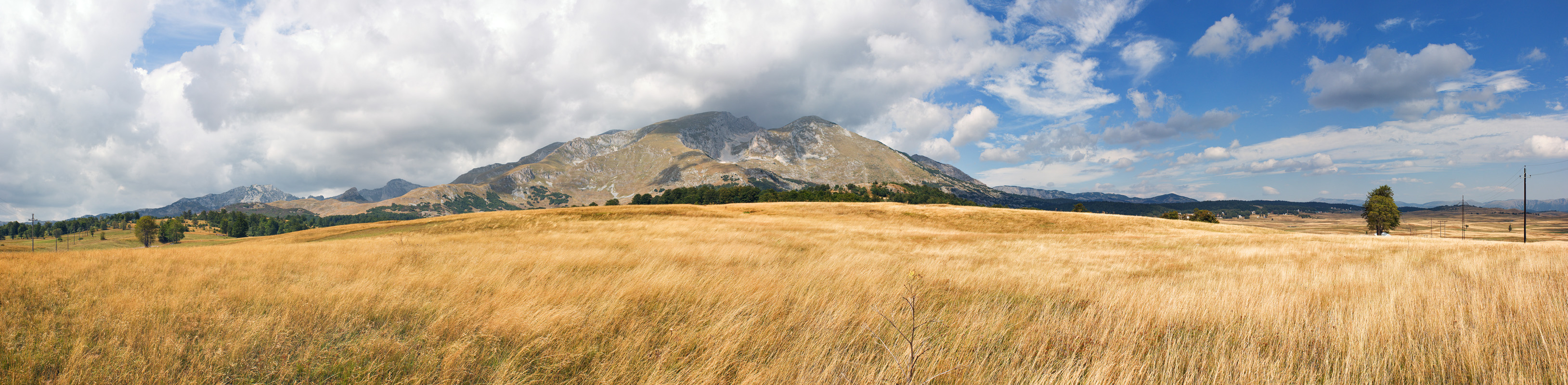
The Krnovo Field
The view of Krnovo Field from Krnovska Glava peak. Krnovo is a distinctive karst plateau, with an elevation of around 1500 meters. This region gets lots of snow in the winter, as it is shielded from warmer sea air by other mountain ranges to the south. It looks quite different in spring, with bright green grass and scattered flower fields.

Krnovska Glava Panorama (VR)
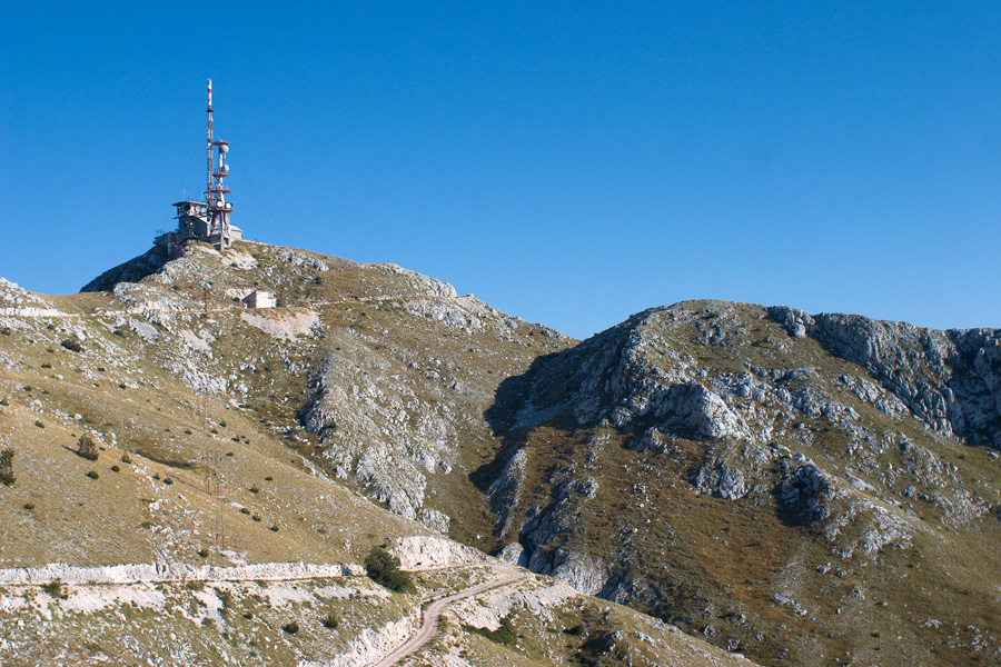
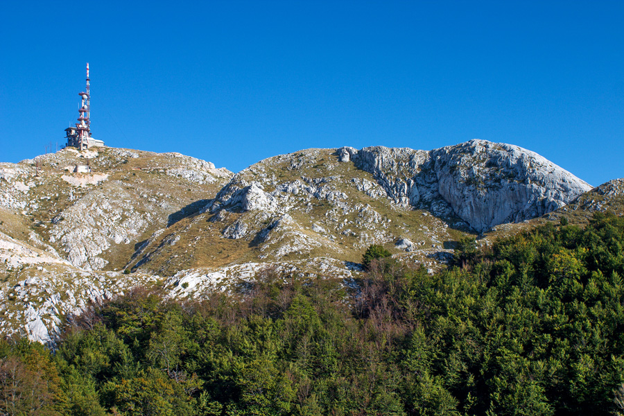
Krnovska Glava is a 1634 meter high peak next to the Šavnik - Nikšić road. A lot of central Montenegro can be seen from here, besides the Krnovo Field and the nearby Vojnik mountain.
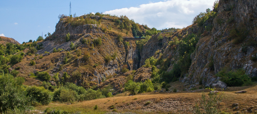
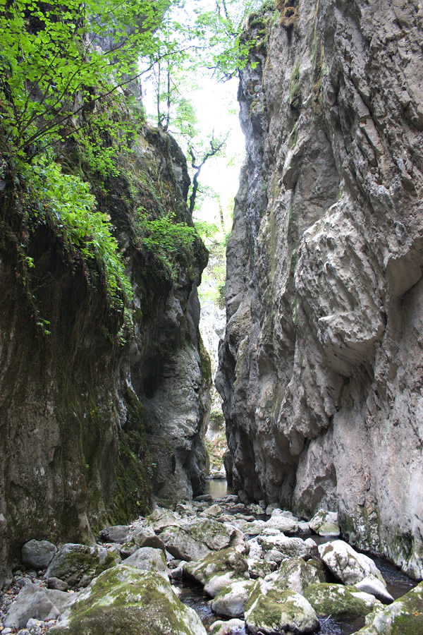
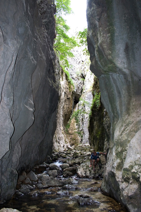
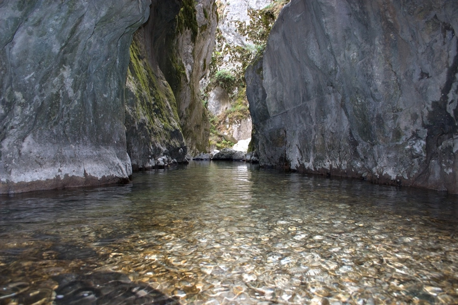
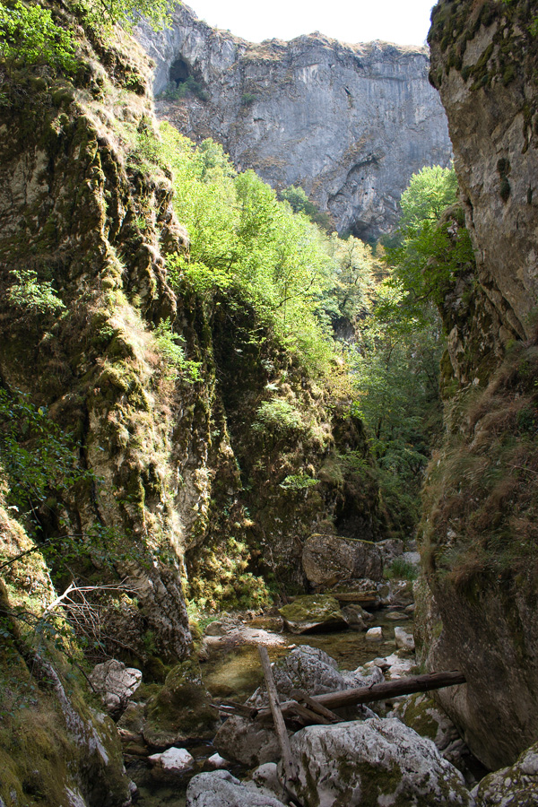
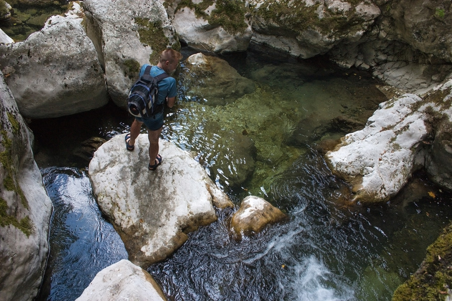
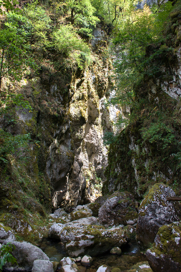
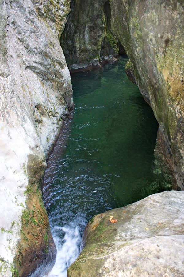
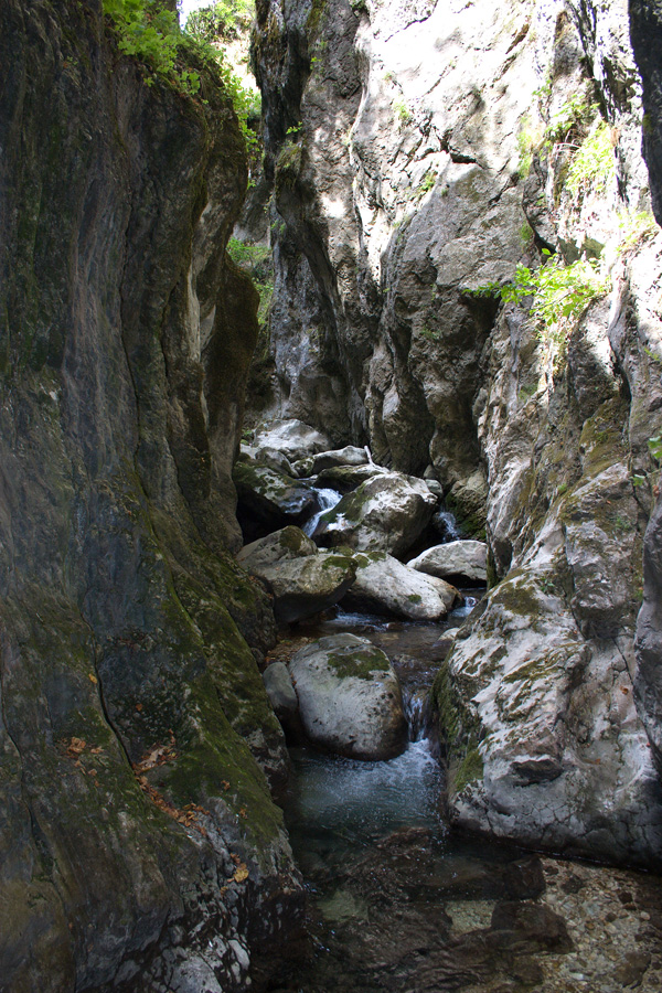
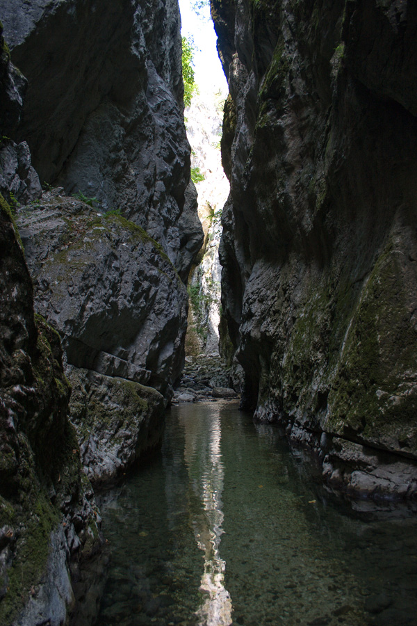
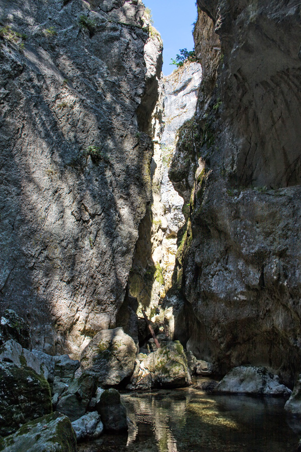
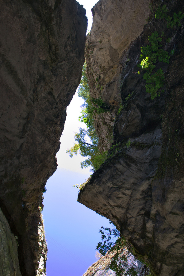
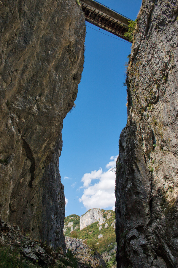
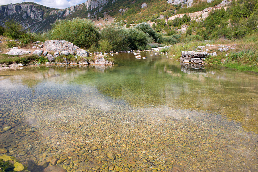
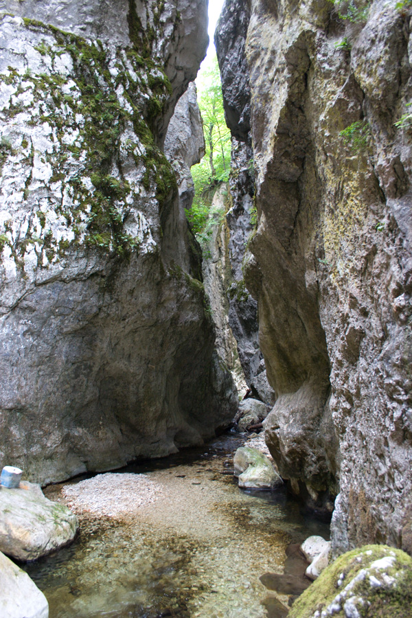
Entrance to Canyon "Nevidio"
River Komarnica springs below southern slopes of Durmitor mountain and flows through a small valley of glacial origin. The end of this valley is blocked by terminal moraine, a large accumulation of debris that has been depositied by glacial erosion. After the Ice Age ended and glaciers dissapeared, soft moraine material was gradually eroded by river Komarnica until this magnificent canyon called "Nevidio" was created. Literal translation of its name into English would be "The Unseen", because of its steep sides and extremely narrow parts that make it inaccessible without special equipment. The next few photographs are from canyon's first 500 meters that are accessible to careful mountaineers during summer season with low water level.
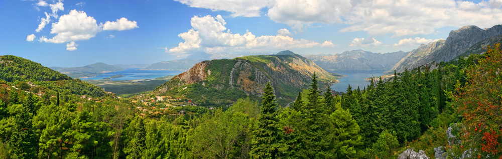
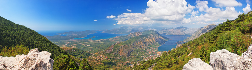
Boka Kotorska Bay
View of the famous bay from curves of the old Kotor - Cetinje road.
Larger size image
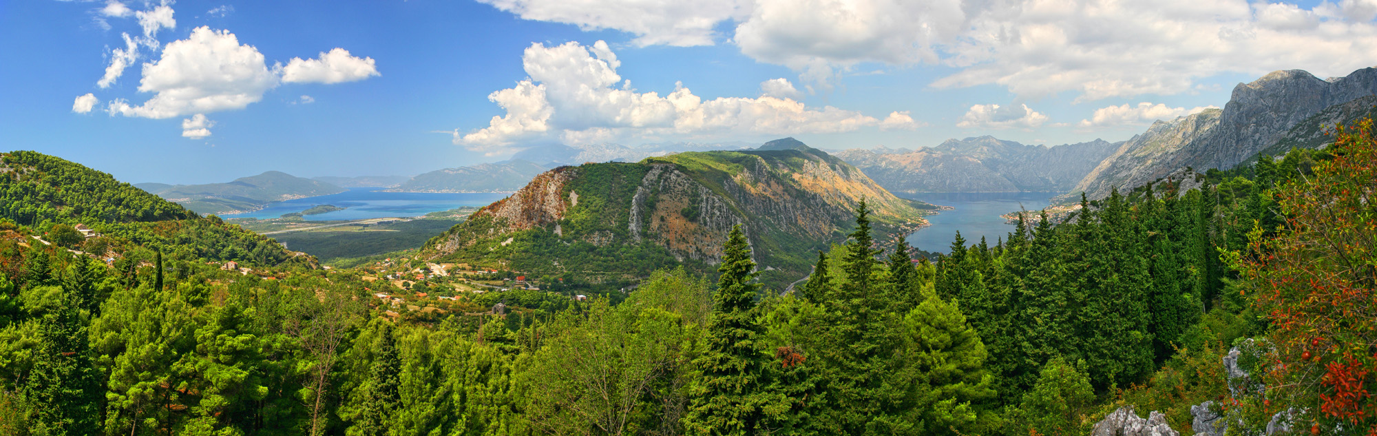
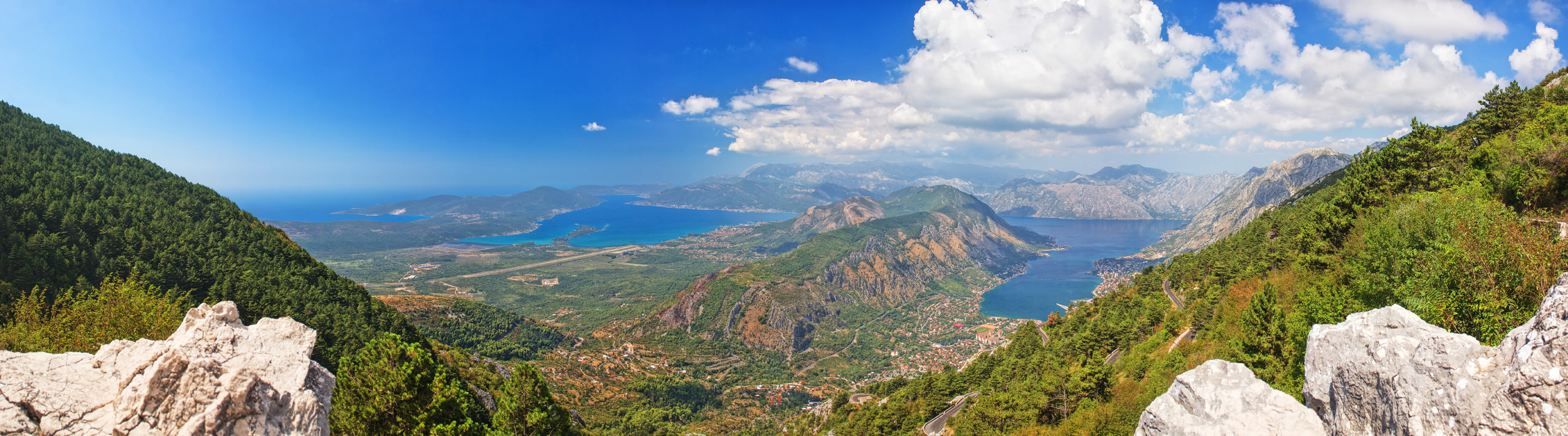
Boka Kotorska Bay
View of the famous bay from curves of the old Kotor - Cetinje road.
Larger size image
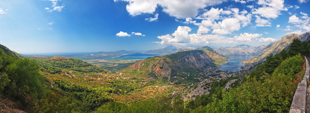
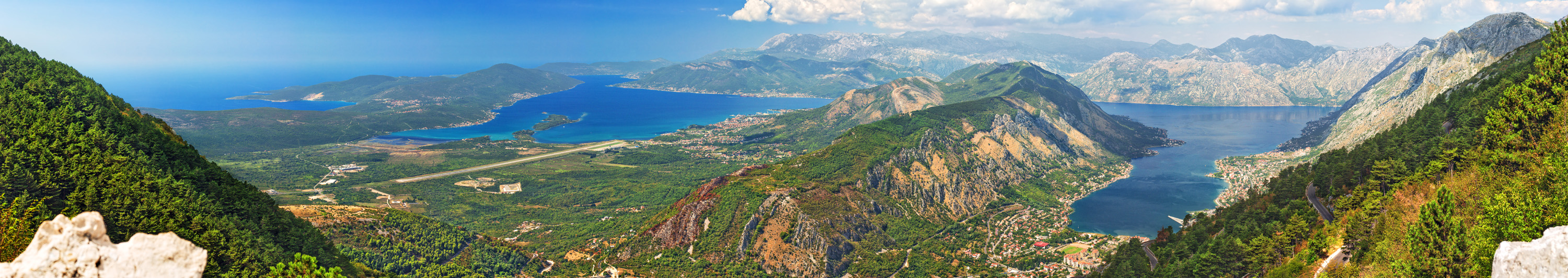
Boka Kotorska Bay
View of the famous bay from curves of the old Kotor - Cetinje road.
Larger size image

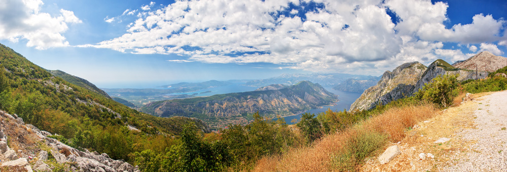
Boka Kotorska Bay
View of the famous bay from curves of the old Kotor - Cetinje road.
Larger size image
Boka Kotorska Bay
View of the famous bay from curves of the old Kotor - Cetinje road.
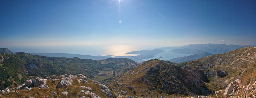
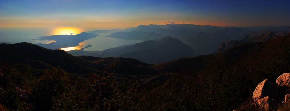
Lovćen Panorama
Štirovnik peak of Lovćen mountain rises 1748 meters above sea level. A part of Boka Kotorska bay called Tivat Bay can be seen from here. On a very clear early morning, even a distant Italian shore can be spotted across the Adriatic Sea.

Lovćen, Štirovnik Peak Panorama (VR)
In the east direction Rumija mountain can be seen, and in southwest is the Orjen mountain, across Boka Kotorska bay. Together with Lovćen, these are the three highest Montenegran mountains above the Adriatic Sea.
Lovćen Panorama
The second summit of Lovćen is called Jezerski Vrh (Lake Peak), and it carries a mausoleum dedicated to Petar Petrović Njegoš, a famous 19th century Montenegran ruler, poet and writer.
Larger size image
Lovćen Panorama
Afternoon view of Adriatic Sea and Boka Kotorska bay from the slopes of Lovćen. (HDR)
Lovćen
Štirovnik peak in the center and Jezerski Vrh (Lake Peak) to the right, as seen from Ivanova Korita village. (HDR)
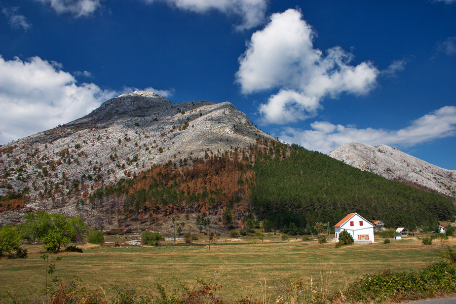
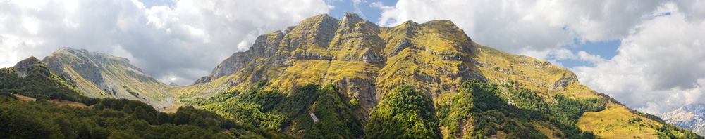
Tali Mountain
Tali mountain is a branch of larger group called Moračke Planine (Mountains of River Morača, named by the river that springs below them). This view is from Ropušnica locality. (HDR)
Larger size image
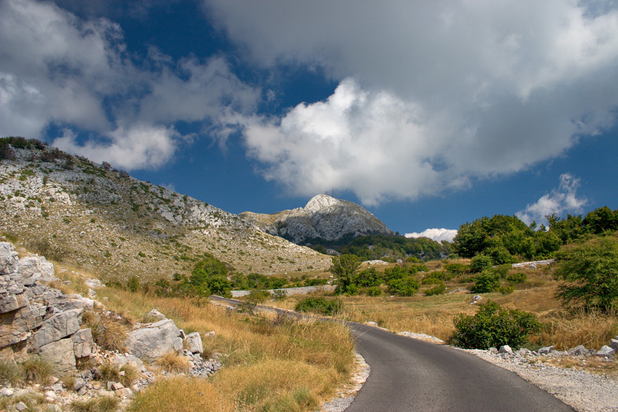
Tali Mountain
Tali mountain is distinctive by its limestone layers and shapes. The highest peak is called Kula and is 2063 meters high. It is accessible to skilled mountaineers without special equipment in summer conditions. However, caution should always be exercised because of loose rocks.
Very large size image (Deep Zoom)

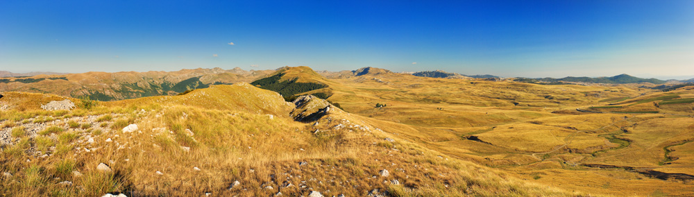
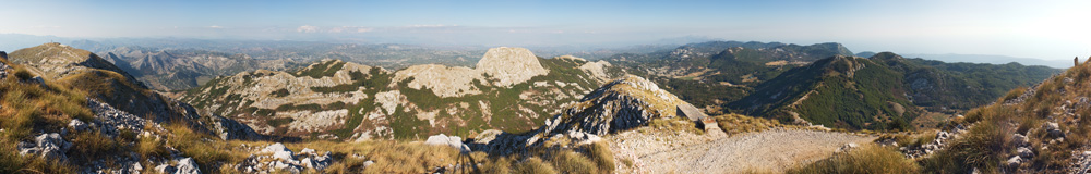
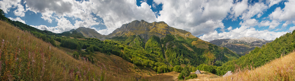
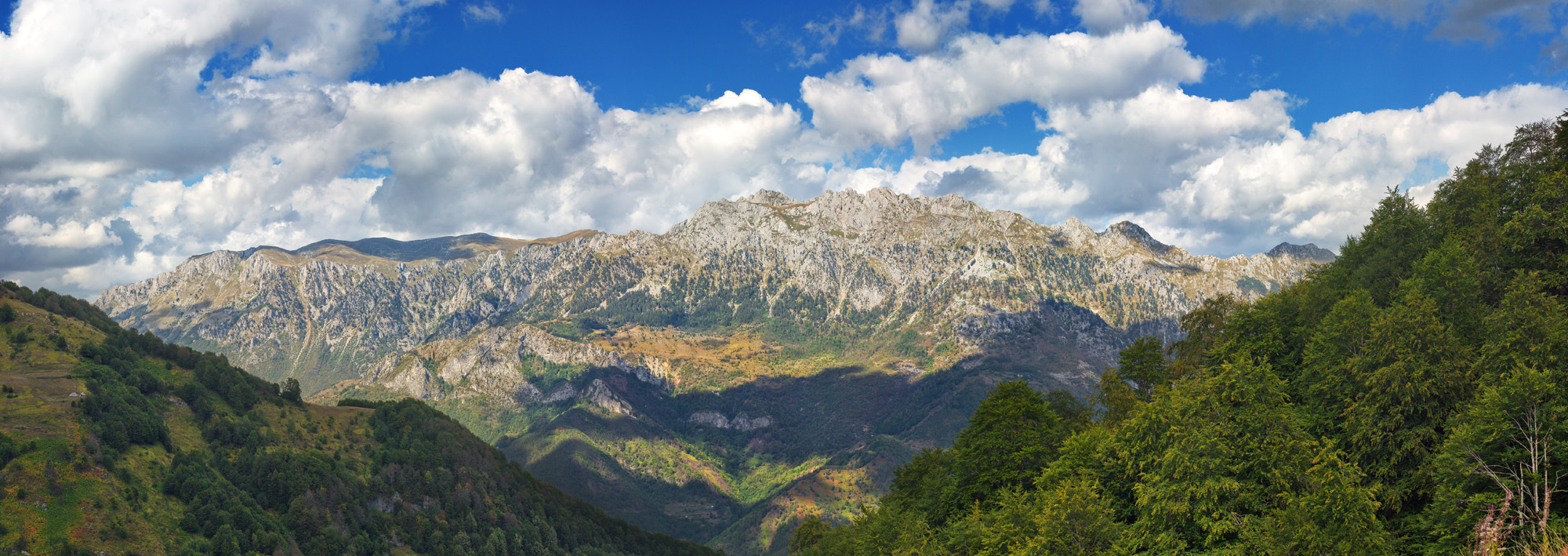
Sinjajevina Mountain
Across Moračke Planine group lies a long Sinjajevina mountain. Its highest ridge with Babin Zub peak (Grandma's Tooth, 2277m) is on this photograph. The rest of the mountain is a large dry karst plateau with average elevation of 1800 meters.
Larger size image